CHRIS
JOHNSON
JOHNSON

I am a highly skilled full stack developer working for the Centre of Ecology and Hydrology Lancaster.
I am passionate about creating elegant and maintainable code. To this end I have hosted best practice tutorials, which have been very well attended by developers from CEH’s sister organisations. They have received very positive feedback and been excellent for knowledge transfer and personal development of attendees.
I have built a web-application testing suite that consists of Android devices, Apple devices and a hub of different browser types. Any developer or system at CEH can use it 24/7 to verify the correct functioning of their applications and also hook it into their automated testing programmes.


I use code to manage infrastructure. Using code means that infrastructure can be quickly replicated, collaboratively evolved and easily understood.
I have put in place the infrastructure and tools to configure, manage and monitor the servers our applications are deployed on. This is now highly automated and controlled such that virtual servers are created as required, managed only via their configuration settings and monitored throughout their lifetime.
Using tools like Terraform means that our Packer templates can be deployed at scale. It also means that we can bring the server environment to developers workstations in the form of Vagrant machines.
Having written many puppet modules, I am well practised in managing lots of different applications over a variety of different architectures.


Working within the Application Development team, I designed a catalogue application which uses a Git repository to persist Metadata records. The use of git repository means that the Metadata records:
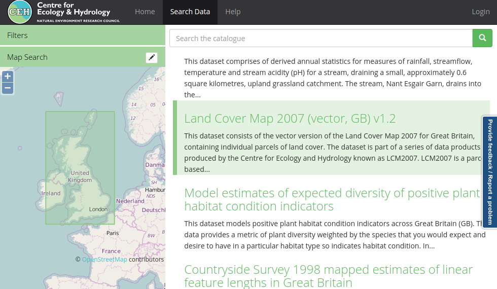
I was also responsible for the creation of the search interface. A key requirement was that the application could support spatial searching of the catalogue. Usability was a key concern for me, that is why I designed the search interface to be as uncluttered as possible.
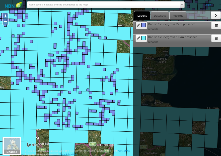
I was responsible for the development of the NBN Gateway mapping capability. As part of this, I designed and developed an application which allows end users to visualise the Biodiversity records held within the gateway.
In order to ensure that the Interactive Mapping Tool could generate images without overwelming the SQL database source, I designed dynamo mapping. A library which supports the generation of Atlas Grade Grid Maps, and controls a double-buffered cache of spatial data.